計畫目標/ Introduction
本研究擬以地理資訊系統( Geographic Information System; GIS ),整合「台灣佛教文獻資料庫」與「台灣佛教數位博物館」等網站資料,發展成為台灣佛教地理資訊平台,以供進階的台灣佛教史地相關研究。
This project uses geographic information system (GIS) technology to integrate temporal and spatial information about Taiwanese Buddhism, especially the spread and distribution of Buddhist temples and centers of worship. This project builds on our previous database of “Digital Database of Taiwanese Buddhism” and our “ Digital Museum of Taiwanese Buddhism ” website. To this rich collection of texts we are now going to add geographic information with possible uses for both researchers and the general public.
內容簡介/ Content
• 資料來源
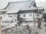
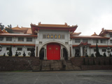
本計劃寺院基本資料來源及類型如附表所示,內容主以過去台灣佛教史學者之研究為根據,並包含此領域專 家闞正宗教授之研究成果。 此外,本計劃除使用寺院本身提供的圖文資訊,更配合 Google-Earth 動態地圖技術,以確實定位該寺院現址之經緯度座標及提供相關交通資訊。本計劃所用文獻,年代始於十七終於二十一世紀,由此得以追蹤台灣佛教數百年來之傳播發展及地域分布。此中,對於古地點的位置,往往需要作大量的考證。
附表:
| 資料來源 |
資料類型 |
資料年代 |
標籤代碼 |
下載
年代 |
備註 |
| 「 內政部民政司/下載專區/寺廟一覽表 」 |
網站 |
更新至 2007 年版 |
[OL] |
2007~
2008 年 |
Microsoft Word 文件 |
| 「水月閣/世界佛教通訊」 |
網站 |
約 1995 年前後 |
[OL] |
2007~
2008 年 |
資料提供:和裕出版社 |
| 各寺院專屬網站 |
網站 |
2007~2009 年 |
[OL] |
2007~
2009 年 |
線上即時資訊 |
| 《重修苗栗縣志:宗教志卷八》 |
彙編 |
2007年4月 |
[G] |
2008年 |
|
•. Sources
As data sources we use previous research done by scholars of Taiwanese Buddhist history. In particular we include the work of Prof. Kan Zhengzong 闞正宗 , who has kindly agreed to serve as advisor for this project. Moreover, we use information provided by the temples themselves and Google Earth that allows us to identify the coordinates of current sites. The collected data stems from the 17 th to the 21 st century and will allow to trace the spread and geographical distribution of Buddhism on Taiwan over these centuries. Often considerable research is needed to ascertain the location of a ancient site.
•. 使用者
本計劃非僅針對學術界設計,同時亦有極大潛能,提供台灣佛教團體及一般民眾更廣泛的用途。我們的長期目標是以本案地理資訊系統,建構一個台灣佛教旅遊資訊平台,使台灣佛教寺院資訊更容易取得。
•. Audience
This project is not exclusively aimed at the scholarly community but also has considerable potential for wider use by the Buddhist community in Taiwan and indeed the general public. Our long-term goal is to offer the data of our GIS system to the Taiwanese tourism board to make information about Taiwanese temples more accessible.
•. 未來目標
在中期目標,將建構一個線上入口網站,提供使用者查詢地點及團體名稱,並可瀏覽地圖。進一步,再依各寺院建築年代及歷程資訊,將抽象的佛教寺院發展史圖像化。為促進寺院旅遊,我們提供寺院二維條碼,可透過手機或 PDA 讀取,並傳送到衛星定位導航系統,進行目的地自動導航。
•. Deliverables
In the mid-term we are going to construct an online portal site that lets users query sites and organization names and view maps. The next step will be to visualize the historical development of Buddhist institutions as evinced by their architecture(biography map). To facilitate tourism we use two-dimensional bar codes that can be read in via cell-phone or PDA and be transmitted to a GPS navigation system.
本計畫擬由數位專家學者參與,茲簡介其工作內容與進行方式如下:
類 別 |
姓名 |
服務機構 / 系所 |
職稱 |
在本研究計畫內擔任之具體工作性質、項目及範圍 |
備 註 |
計畫主持人 |
惠敏法師 |
法鼓佛教學院 |
校長 |
統籌規劃執行本計畫 |
|
共同主持人 |
杜正民 |
法鼓佛教學院 |
副校長 |
專案管理。 |
|
共同主持人 |
馬德偉
Marcus Bingenheimer |
法鼓佛教學院 |
圖資館館長 |
專案管理與影像資料庫規劃推動。 |
|
共同主持人 |
洪振洲 |
法鼓佛教學院 |
圖資館資訊組組長 |
網頁技術指導和程式處理。
|
|
專案顧問 |
闞正宗 |
菩提長青出版社 |
著作兼發行人 |
榮譽顧問。 |
《台灣佛寺導遊》作者 |
研究助理 |
黃仁順 |
法鼓佛教學院 |
|
台灣寺院資訊蒐集,基礎基料庫建構,繪製台灣佛教電子地圖。 |
|
技術指導 |
法源法師 |
法鼓佛教學院 |
|
專案執行初期技術指導及顧問。 |
|
| 數位典藏組 |
李志賢 |
法鼓佛教學院 |
組員 |
網站前後端程式設計及相關技術處理。 |
|
研究助理 |
張伯雍 |
法鼓佛教學院 |
研究助理 |
中西曆對照表編寫,行政文書作業。 |
|
研究助理 |
許智偉 |
法鼓佛教學院 |
研究助理 |
寺院資料庫建置。 |
|